Hardanger

FOR THOSE WHO SWEAR BY WORK BEFORE PLEASURE

The concept of work before pleasure is deeply ingrained in the Norwegian psyche. When each step of the hike to the Trolltunga or along the Queen’s Path leaves your quads quivering, you can look forward to a well-deserved glass of cider. Just like Norway’s Queen Sonja has done before you. Don’t worry, though, there are plenty of less strenuous peaks to reach.

Important information for hiking in Norwegian nature

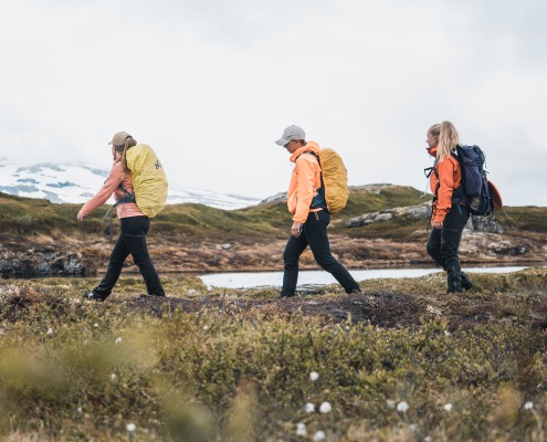
  • Wear waterproof hiking boots. (It wouldn’t hurt to bring an extra pair of trainers as well.)
  • Bring something to eat along the way and enough water to drink.
  • Remember that there may still be snow in the mountains, even in the summertime.
  • Dress for the weather, but remember that the weather changes quickly at high altitude, so bring some extra clothing.
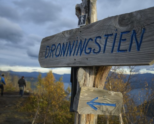
Dronningstien, HM Queen Sonjas panoramic hikingtrail, Hardangerfjorden

Package

HM Queen Sonjas Hiking Trail

When sailing with Aurora of The Fjords from Eidfjord or Ulvik to the HM Queen Sonjas Hiking Trail (Dronningstien) you get to experience all the best of Hardanger in the same day.

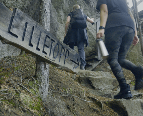
Lilletopp, Hardabger, Hardagerfjord, Hiking

Roundtrip

Eidfjord/Ulvik-Tyssedal-Eidfjord/Ulvik

Enjoy a full day trip with cruise on the Hardangerfjord and a hike to Lilletopp or visit the museum.

Roundtrip

Lofthus-Odda-Lofthus

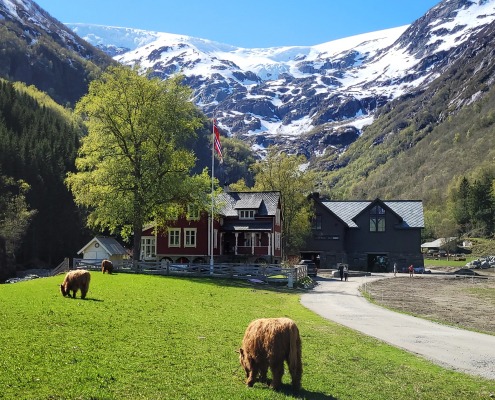
Go shopping in the streets of Odda or visit the gourmet restaurant at Buer Farm.

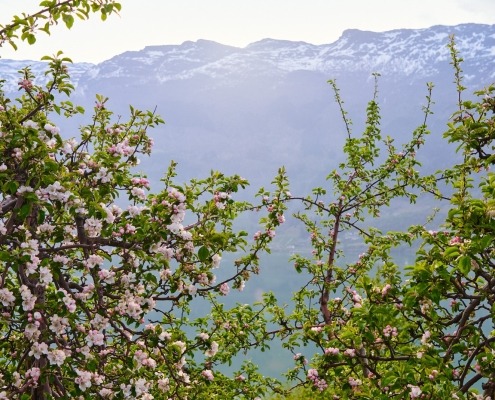
The Hardangerfjord, Apple blossom

Hardanger

All trips

We are sailing daily from Eidfjord to Ulvik, further on the Lofthus and doing several  stops along the fjord all the way to Odda.

HM Queen Sonjas Panoramic Hiking Trail

Facts about the HM Queen Sonjas Panoramic Hiking Trail (Dronningstien)

  • Disembark at Lofthus
  • A challenging 14 km hike
  • The Fjords have a shuttle bus that will take you to Røte, which is the starting point for the hike.
  • The route ends back at Lofthus.
  • Estimated time: 5–7 hours
View from The Queens hiking trail, Dronningstien

Pure hiking pleasure

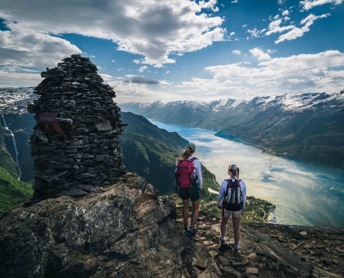
The HM Queen Sonjas Panoramic Hiking Trail (Dronningstien) is enough of a challenge to make both knees and thighs protest. But the view it rewards you with is so dizzyingly beautiful that you quickly forget to feel the burn. The hike over Kvanndalshøgdi, from Kinsarvik to Lofthus, is unique. Maybe because the Norwegian Trekking Association’s usual Ts that mark hiking routes the length and breadth of Norway have been replaced by a royal blue “D” for dronning, which means queen in Norwegian. Or maybe because it is impossible not to be charmed into sharing a bit of our packed lunch with an itinerant goat along the way. It could even be because following in the footsteps of a queen – completely free of charge – makes us feel extra special.

Since Queen Sonja inaugurated the hiking trail in 2013, it has become one of Norway’s most popular hiking routes. Hikers pass lakes and bogs in a steeply upward trajectory. And, oh my gosh, isn’t that the Troll’s Tongue (Trolltunga) rock formation? No, it is the iconic Wolf’s Maw (Ulfskjaft), which, at first glance, is hard to distinguish from the super-celebrity that stands a little further up the fjord. An Insta-worthy shot that cannot be missed. At the top, where the cairn thrusts skyward at Duk, the surroundings are likely to take your breath away. For there is the Folgefonna glacier, there is Oksen on the other side of the fjord, and waaaay down there, 1,100 metres down to be exact, lies the scenic village of Lofthus surrounded by orchards. This is pure hiking pleasure! Foreign visitors coming here on a clear summer’s day will be shocked to realise that the romantic advertisements for Norway they have seen a thousand times are 100 per cent true to life.

But the day is not over, because now you are about to descend Norway’s oldest stone staircase – the Monk Steps (Munketreppene). They were laid by English monks in the early 13th century. The same monks who started cultivating fruit trees and making cider.

The queens hiking trail, Hardanger, Dronningstien

Taken by surprise on the HM Queen Sonjas Panoramic Hiking Trail

“A lot of people don’t realise that the way down is the toughest part of the hike. The descent is both long and steep. So it’s important to go at your own speed to spare your knees,” says Ida Eidsnes. She is Marketing Manager and shopkeeper at Lofthus Sideri, a cider shop situated exactly where the Queen’s Path comes to an end. What luck for thirsty hikers!

“Our fridge is probably the most photographed in Norway,” she says.

The fridge is solidly planted in the midst of gorgeous countryside and is a help-yourself service, open 24 hours a day. Its shelves are well stocked with ice-cold local apple juice.

“Those who slake their thirst here leave some cash in the box or make a mobile payment. It works great, and we have almost no theft. Hikers are a special bunch,” she laughs. And if you are hungry after your exertions, Lofthus Sideri also serves food and cider made on the premises.

“A bite of something salty tastes delicious after a long hike, and last year we launched our popular Hardanger Wrap,” explains Ida. The wrap is based on the Hardanger delicacy hakkasteik – a combination of salted and smoked pork and lamb is ground into forcemeat along with some pearl barley, and then fried. It is served in a traditional soft potato pancake (lompe) with red onions and a dollop of sour cream. Perfect with a glass of sparkling cider made from the farm’s own apples.

Trolltunga (The Trolls Tongue)

Facts about Trolltunga

  • Disembark at Tyssedal
  • An extremely challenging round trip (27 km if you start at Skjeggedal; 20 km if you start at Mågelitopp)
  • Departure point: Tyssedal
  • Estimated time: 8–12 hours from Skjeggedal; 7–10 hours from Mågelitopp

Trolltunga – face to face with a legend

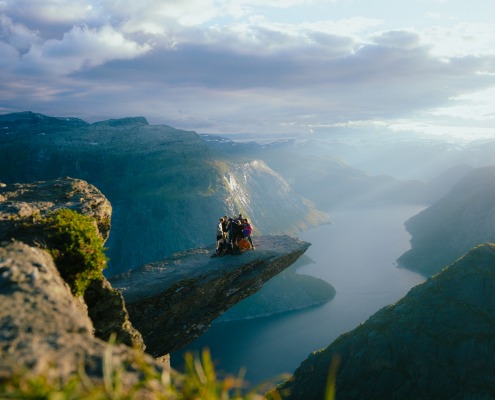
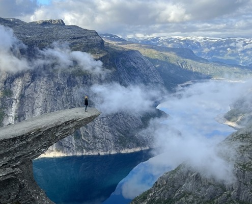
Most Norwegians have grown up listening to the tale of Askeladden, the quick-witted boy who challenged a troll to an eating competition. For us, it is perfectly obvious what the Trolltunga rock formation is all about. For others, an explanation may be in order. What looks like a gigantic granite diving board is, according to local legend, the tongue of a troll that turned to stone when it dared to make faces at the sun. The tongue juts out of the mountainside 700 metres above the Ringedalsvatnet lake, and makes a stunning destination that many dream of experiencing – and photographing. But is the Troll’s Tongue a hike anyone can make?

“In 2023, 79,000 hiked up to the Troll’s Tongue – and 87 per cent of them were foreign visitors. Different people experience the hike very differently,” says Åse Marie Evjen, CEO of Trolltunga AS.

She explains that Norwegians who are in good physical shape often find the hike easier than they expected. Then there are the foreign visitors who may not be so used to hiking. The hike to the Troll’s Tongue is potentially their first ever steep climb, and they find it extremely challenging.

“The route goes through high-mountain terrain and takes 8–12 hours, depending on where you start and how you pace yourself. It’s important to prepare properly, with a pair of sturdy mountain boots, and bring enough food and drink,” says Evjen. She adds that there is often snow on the path until well into June, so hikers need to play safe and pack warm clothing as well as sunglasses and suncream.

Trolltunga, Trolltunga Adventures, The Hardangerfjord, Hardanger

Bonjour! Guten Tag! How are you doing?

Despite the Trolltunga being one of Norway’s most popular hiking destinations, there is no feeling of walking in a procession. The only place that is crowded is the tongue itself, where everyone wants to take the obligatory selfie. It is impressive to see how Germans, French and Americans – the most numerous nationalities – politely wait their turn, in compliance with the unwritten queueing system. No one sneaks in here. Who knows? Maybe beautiful nature has a civilising effect.

“There is usually a mountain guard at the Trolltunga, who makes sure that everyone has the opportunity to take ‘their’ picture. According to our measurements, people take on average half a minute capturing a permanent record of their time at one of the world’s most famous rock formations. There’s certainly no dawdling about,” says Evjen.

But this is a hike that offers more than the destination itself. Along the way, you may be lucky enough to spot a ptarmigan, stoat or meadow pipit. The truly fortunate may even see a sea eagle glide and swoop above the fjord landscape on wings over two metres wide. Looking down where you step, notice how nature has decorated the path for you, with delicate bluebells, beautiful dryads or even the rare glacier buttercup. This is a hike to delight all the senses!

Lilletopp

Facts about Lilletopp

  • Disembark at Tyssedal
  • Easy 1.4 km walk on a well-kept path with steps and handrails
  • Estimated time: 1 hour
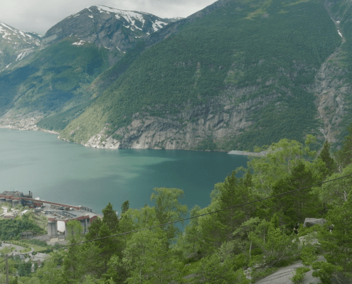
view from Lilletopp, Hardanger, Hardangerfjord

Lilletopp – an activity for everyone

If you feel exhausted just reading about quaking muscles and mountain hiking, Lilletopp is an exciting alternative from the ferry dock at Tyssedal.

“Lilletopp is the perfect destination for those unable or unwilling to make the hike to the Troll’s Tongue,” says Åsne Dolve Meyer. She heads the Education Department at the Norwegian Museum of Hydropower and Industry (Kraftmuseet) and is a self-confessed hydropower nerd.

“The people who stand up there at the Troll’s Tongue feel they are surrounded by untouched nature. What they don’t know is that the Ringedalsvatnet lake, which looks pristine and lovely from the top, is actually a hydropower reservoir,” she reveals.

Lilletopp is also part of the old hydropower plant Tysso I, which was completed in 1908. The water intake channels were blasted through the rock up to Lilletopp, where the water was collected in a basin inside the mountain. It was then sent in pipes down the precipitous mountainside that looms over Tyssedal. This was the pioneering start of Norway’s love affair with hydroelectric power. Does that sound rather dull? Think again.

Hydropower changed Norwegian history. Among other things, it halted the flow of emigrants travelling to America in search of a better life. Now there was work enough at home.

“Foreign visitors who come here are astonished and delighted, while Norwegians have long had a nonchalant attitude to the production of electricity. That all changed when the entire country was hit by last year’s electricity price hikes. We are now noticing an increased awareness of this industrial heirloom,” she says.

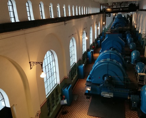
Kraftmuseet, Tyssedal, Hardangerfjord, Hardanger

Like being in a cathedral

But a visit here is about more than electricity. Power plants were the signature buildings of their day. Like today’s opera houses and theatres. It is no coincidence that the old power plant at Tyssedal was designed by Thorvald Astrup, the same architect behind Oslo’s Kulturslottet Soria Moria.

“I love the contrast between the wild, unspoilt landscape and the industrial culture that breaks up the National Romantic vision. For me, going inside the old power stations, with their robust machinery surrounded by brass and marble panels, still feels like being in a cathedral,” says Meyer.

Having looked and listened and learned a lot at the Museum of Hydropower and Industry, you can join a guided tour up through the water intake tunnels inside the mountain to Lilletopp. There, the former warden’s cottage has been turned into a cosy café, where you can enjoy a cup of coffee and some freshly made fluffy pancakes. In the true spirit of work before pleasure – naturally.

Where to stay?

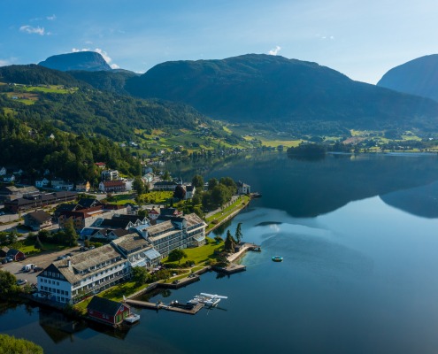
The Hardangerfjord area offers a wide selection of accomodations. You can choose from campsites, tree huts, historic hotels, top notch hotels and cabins. At Visit Hardangerfjord you can easily get an overview and book your next stay in Hardanger. Nothing is like a good night sleep after hiking and cruising in Hardanger!